Realm · 886–1045
Bagratid Armenia
Bagratid Armenia appears on the map from 886 to 1045. At its greatest recorded extent, in 886, it covered about 99,224 km².
See Bagratid Armenia on the map in 886
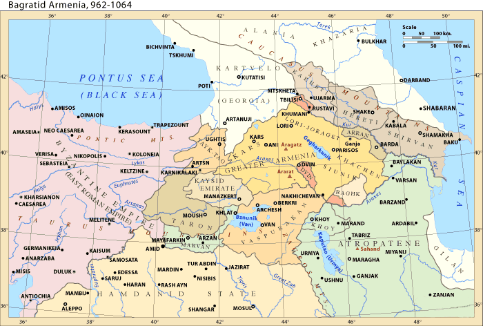
- On the map
- 886–1045
- Greatest extent
- 886, about 99,224 km²
- Read more
- Wikipedia: Bagratid Armenia · Wikidata Q2622868
Territory through time
| Years | Area drawn |
|---|---|
| 886–891 | 99,224 km² |
| 892–897 | 97,862 km² |
| 898–910 | 98,064 km² |
| 911–935 | 56,712 km² |
| 936–946 | 58,941 km² |
| 947–999 | 58,869 km² |
| 1000–1009 | 53,011 km² |
| 1010–1027 | 52,795 km² |
| 1028–1033 | 38,971 km² |
| 1034–1039 | 39,164 km² |
| 1040–1045 | 39,164 km² |