Realm · 1305–1467
Beylik of Karaman
Beylik of Karaman appears on the map from 1305 to 1467. At its greatest recorded extent, in 1363, it covered about 100,291 km².
See Beylik of Karaman on the map in 1363
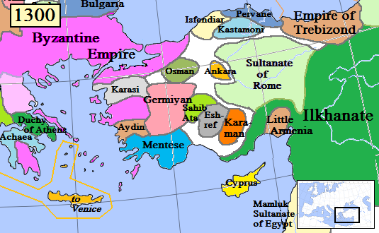
- On the map
- 1305–1467
- Greatest extent
- 1363, about 100,291 km²
- Read more
- Wikipedia: Karamanids · Wikidata Q1469100
Territory through time
| Years | Area drawn |
|---|---|
| 1305–1313 | 27,701 km² |
| 1314–1325 | 81,771 km² |
| 1326–1332 | 91,156 km² |
| 1333–1343 | 99,408 km² |
| 1344–1351 | 99,626 km² |
| 1352–1362 | 91,375 km² |
| 1363–1384 | 100,291 km² |
| 1385–1401 | 100,143 km² |
| 1402–1406 | 99,804 km² |
| 1407–1428 | 100,143 km² |
| 1429–1462 | 100,239 km² |
| 1463–1467 | 100,270 km² |