Realm · 207–1832
Chámpa
Chámpa appears on the map from 207 to 1832. At its greatest recorded extent, in 875, it covered about 130,300 km².
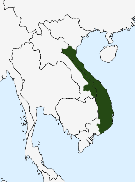
- On the map
- 207–1832
- Greatest extent
- 875, about 130,300 km²
- Read more
- Wikipedia: Champa · Wikidata Q216786
Territory through time
| Years | Area drawn |
|---|---|
| 207–545 | 72,677 km² |
| 546–554 | 79,258 km² |
| 555–616 | 77,375 km² |
| 617–640 | 77,818 km² |
| 641–874 | 77,878 km² |
| 875–1027 | 130,300 km² |
| 1028–1055 | 130,213 km² |
| 1056–1071 | 130,300 km² |
| 1072–1187 | 123,634 km² |
| 1188–1205 | 123,379 km² |
| 1220–1313 | 123,379 km² |
| 1314–1362 | 111,356 km² |
| 1363–1428 | 111,123 km² |
| 1429–1474 | 92,758 km² |
| 1475–1539 | 8,027 km² |
| 1540–1647 | 7,917 km² |
| 1648–1652 | 7,917 km² |
| 1683–1793 | 3,661 km² |
| 1794–1795 | 3,775 km² |
| 1796–1798 | 3,888 km² |
| 1799 | 3,661 km² |
| 1800–1802 | 3,888 km² |
| 1803–1829 | 3,661 km² |
| 1830–1832 | 3,661 km² |