Realm · 990–1249
County of Toulouse
County of Toulouse appears on the map from 990 to 1249. At its greatest recorded extent, in 1066, it covered about 52,887 km².
See County of Toulouse on the map in 1066
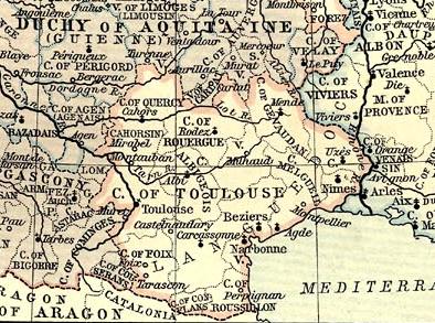
- On the map
- 990–1249
- Greatest extent
- 1066, about 52,887 km²
- Part of
- Kingdom of France
- Read more
- Wikipedia: County of Toulouse · Wikidata Q1334322
Territory through time
| Years | Area drawn |
|---|---|
| 990–1027 | 21,359 km² |
| 1028–1039 | 21,287 km² |
| 1040–1065 | 21,359 km² |
| 1066–1146 | 52,887 km² |
| 1147–1151 | 52,840 km² |
| 1152–1187 | 52,887 km² |
| 1188–1205 | 52,816 km² |
| 1206–1209 | 52,840 km² |
| 1210–1215 | 45,320 km² |
| 1220–1226 | 1,105 km² |
| 1236–1240 | 48,206 km² |
| 1241–1249 | 48,206 km² |