Realm · approximate borders · 850–553 BCE
Edom
Kingdom south of the Zered as far as the Gulf of Aqaba, with its capital at Bozrah (Busayra); it broke from Judah in the mid-9th century BCE, paid tribute to Assyria from 734, and fell to Nabonidus of Babylon c. 552 BCE.
The western border on the Arabah is approximate; Edom later expanded into the Negev. Sources: Wikipedia 'Edom'; Shepherd plate 5.
See Edom on the map in 850 BCE
- On the map
- 850–553 BCE
- Capital
- Bozrah (Busayra)
Rulers named in the sources
- Qaus-malaku c. 730 BCE
- Qaus-gabri c. 670 BCE
States of the Middle East, 2400 BCE–1886
Among the smaller states of Anatolia, the Levant, Mesopotamia, Arabia, Iran and the South Caucasus were Bronze and Iron Age kingdoms (Ebla, Mari, Yamhad, Kizzuwatna, Arzawa, Ugarit, Aram-Damascus, Ammon, Moab, Edom, Mannaea), the city-kingdoms of Cyprus, Characene, Elymais, Hatra, Kinda and Muhammad's state at Medina; the Caucasian kingdoms and emirates of the 9th–12th centuries (Tbilisi, Lori, Kakheti-Hereti, Syunik, Kars) and the dynasties of the 'Iranian intermezzo' (Sallarids, Rawwadids, Hasanwayhids, Kakuyids, Marwanids, Uqaylids, Mirdasids, Mazyadids, Ikhshidids); the Burids of Damascus, the Nizari Ismaili castles, the atabegs of Azerbaijan, Fars, Luristan and Kerman; the eastern Anatolian beyliks (Saltukids, Mengujekids, Shah-Armens, Artuqids, Eretnids, Kadi Burhan al-Din, Erzincan, Tacettin, Lâdik, Alaiye); the Mamluk pashas of Baghdad; Arabian states from the Sulayhids to the Jabrids, Bani Khalid, Kathiri, Mahra and Lahej; and the South Caucasus khanates of 1747–1828. Few pre-modern sources describe frontiers.
Sources
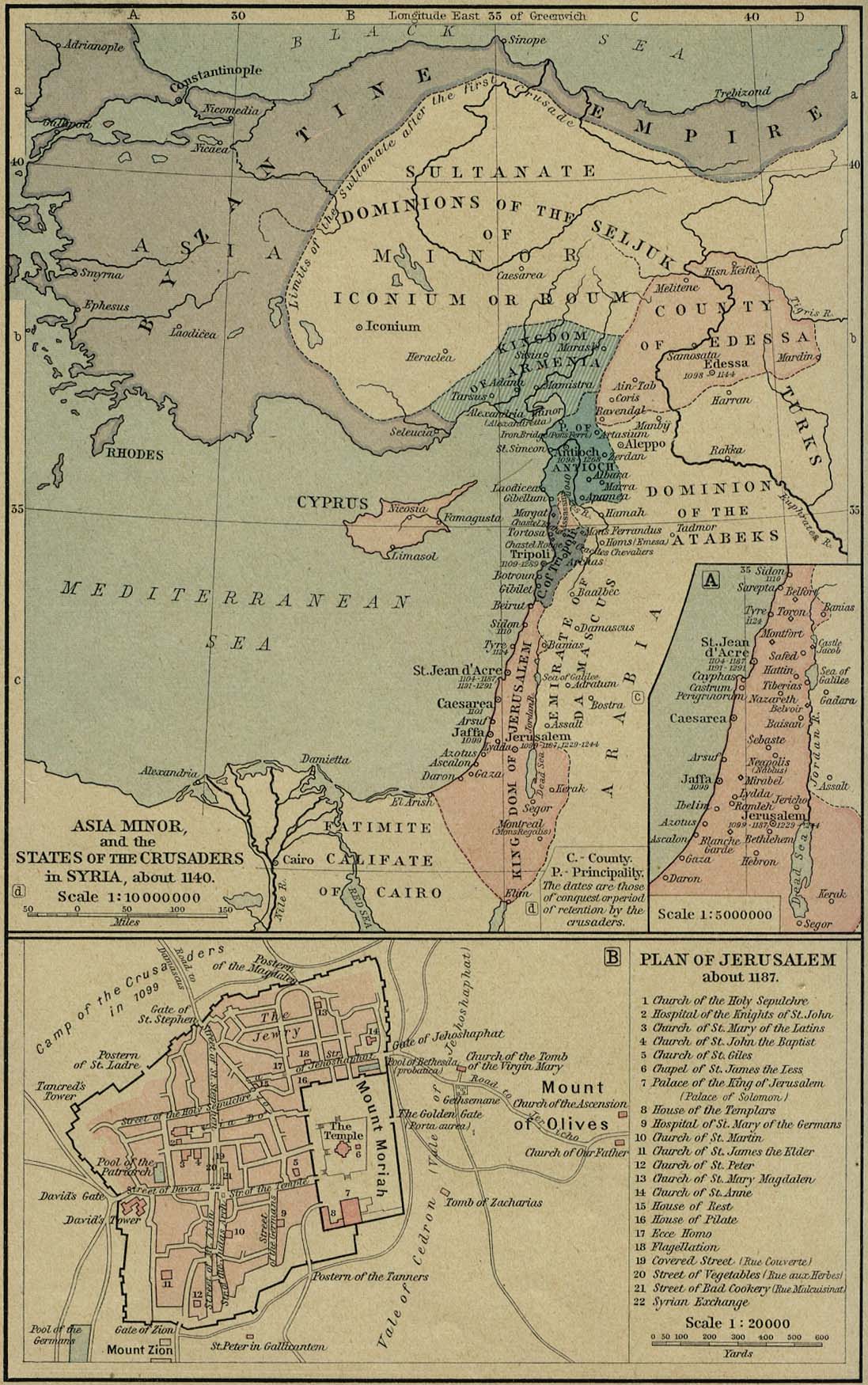
- W. R. Shepherd, Historical Atlas (1923): 'Asia Minor and the States of the Crusaders in Syria, about 1140' (PCL, University of Texas)
- W. R. Shepherd, Historical Atlas (1923): 'The Assyrian Empire and the Region about the Eastern Mediterranean, 750–625 B.C.' (PCL)
- Wikidata: Beylik of Lâdik (Q717451)
- Wikipedia: Ebla
- Wikipedia: Mari, Syria
- Wikipedia: Yamhad
- Wikipedia: Kizzuwatna
- Wikipedia: Arzawa
- Wikipedia: Ugarit
- Wikipedia: Characene
- Wikipedia: Elymais
- Wikipedia: Hatra
- Wikipedia: Kingdom of Kinda
- Wikipedia: Shaddadids
- Wikipedia: Hazaraspids
- Wikipedia: Qutlugh-Khanids
- Wikipedia: Saltukids
- Wikipedia: House of Mengüjek
- Wikipedia: Shah-Armens
- Wikipedia: Shaki Khanate
- Wikipedia: Shirvan Khanate
- Wikipedia: Quba Khanate
- Wikipedia: Baku Khanate
- Wikipedia: Derbent Khanate
- Wikipedia: Talysh Khanate
- Wikipedia: First Islamic state
- Wikipedia: Aram-Damascus
- Wikipedia: Ammon
- Wikipedia: Moab
- Wikipedia: Edom
- Wikipedia: Hasanwayhids
- Wikipedia: Kakuyids
- Wikipedia: Uqaylid dynasty
- Wikipedia: Mirdasid dynasty
- Wikipedia: Mahra Sultanate
- Wikipedia: Sultanate of Lahej
- Wikipedia: Bani Khalid (tribe)
- Wikipedia: Ancient history of Cyprus
- Wikipedia: Bit Adini
- Wikipedia: Burid dynasty
- Wikipedia: Constitution of Medina
- Wikipedia: Emirate of Tbilisi
- Wikipedia: Kingdom of Kakheti-Hereti
- Wikipedia: Kingdom of Syunik
- Wikipedia: Kingdom of Vanand
- Wikipedia: Mannaea
- Wikipedia: Nizari Ismaili state
- Wikipedia: Sallarid dynasty
- Wikipedia: Kingdom of Tashir-Dzoraget
- Wikipedia: Rawwadid dynasty
- Wikipedia: Artuqids
- Wikipedia: Bavand dynasty
- Wikipedia: Eldiguzids
- Wikipedia: Erivan Khanate
- Wikipedia: Ganja Khanate
- Wikipedia: Ikhshidid dynasty
- Wikipedia: Kadi Burhan al-Din
- Wikipedia: Karabakh Khanate
- Wikipedia: Kathiri
- Wikipedia: Nakhichevan Khanate
- Wikipedia: Sulayhid dynasty
- Wikipedia: Emirate of Erzincan
- Wikipedia: Emirate of Limnia
- Wikipedia: Eretnid dynasty
- Wikipedia: Alaiye
- Wikipedia: Banu Mazyad
- Wikipedia: Fath-Ali Khan of Quba
- Wikipedia: Jabrids
- Wikipedia: Kingdom of Hatra
- Wikipedia: Mamluk dynasty of Iraq
- Wikipedia: Marwanid dynasty (Diyar Bakr)
- Wikipedia: Beylik of Lâdik
- Wikipedia: Salghurids