Realm · 1236–1571
Hafsid Dynasty
Hafsid Dynasty appears on the map from 1236 to 1571. At its greatest recorded extent, in 1344, it covered about 224,295 km².
See Hafsid Dynasty on the map in 1344
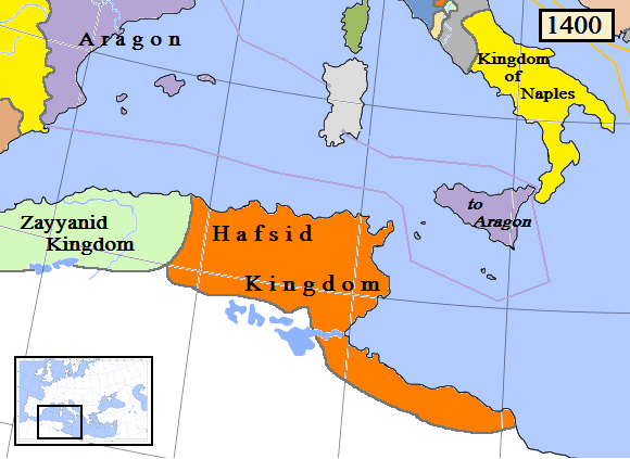
- On the map
- 1236–1571
- Greatest extent
- 1344, about 224,295 km²
- Read more
- Wikipedia: Hafsid dynasty · Wikidata Q752662
Territory through time
| Years | Area drawn |
|---|---|
| 1236–1293 | 224,040 km² |
| 1294–1343 | 224,190 km² |
| 1344–1351 | 224,295 km² |
| 1363–1452 | 224,190 km² |
| 1453–1511 | 224,190 km² |
| 1512–1520 | 222,431 km² |
| 1521–1533 | 222,305 km² |
| 1534–1539 | 221,486 km² |
| 1540–1551 | 222,305 km² |
| 1552–1555 | 173,148 km² |
| 1556–1563 | 88,079 km² |
| 1564–1571 | 88,079 km² |