Country · since 1636
Kingdom of Bhutan
Kingdom of Bhutan appears on the map from 1636 to today. At its greatest recorded extent, in 1947, it covered about 71,861 km².
See Kingdom of Bhutan on the map in 1947
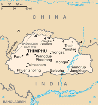
- On the map
- 1636 – today
- Greatest extent
- 1947, about 71,861 km²
- Read more
- Wikipedia: Bhutan · Wikidata Q917
Territory through time
| Years | Area drawn |
|---|---|
| 1636–1682 | 41,700 km² |
| 1683–1787 | 40,266 km² |
| 1788–1793 | 40,754 km² |
| 1794–1813 | 40,456 km² |
| 1814 | 40,754 km² |
| 1815–1821 | 40,266 km² |
| 1822–1841 | 40,425 km² |
| 1842–1889 | 40,478 km² |
| 1890–1911 | 40,398 km² |
| 1912–1913 | 40,907 km² |
| 1914–1938 | 40,722 km² |
| 1939–1946 | 71,218 km² |
| 1947 | 71,861 km² |
| 1948–1952 | 71,218 km² |
| 1953–1978 | 40,722 km² |
| 1979–1982 | 40,322 km² |
| 1983–1991 | 40,722 km² |
| since 1992 | 40,488 km² |