Realm · 961–1235
Kingdom of Castile
Kingdom of Castile appears on the map from 961 to 1235. At its greatest recorded extent, in 1099, it covered about 257,218 km².
See Kingdom of Castile on the map in 1099
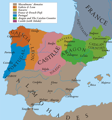
- On the map
- 961–1235
- Greatest extent
- 1099, about 257,218 km²
- Read more
- Wikipedia: Kingdom of Castile · Wikidata Q179293
Territory through time
| Years | Area drawn |
|---|---|
| 961–1009 | 39,927 km² |
| 1010–1027 | 39,998 km² |
| 1040–1045 | 34,277 km² |
| 1046–1065 | 167,203 km² |
| 1066–1071 | 43,201 km² |
| 1072–1084 | 201,772 km² |
| 1085–1093 | 245,563 km² |
| 1094–1098 | 245,271 km² |
| 1099–1110 | 257,218 km² |
| 1111–1125 | 155,401 km² |
| 1139–1146 | 187,517 km² |
| 1147–1151 | 216,087 km² |
| 1152–1168 | 216,906 km² |
| 1169–1187 | 106,420 km² |
| 1188–1201 | 106,179 km² |
| 1202–1215 | 116,987 km² |
| 1216–1226 | 156,417 km² |
| 1227–1235 | 156,343 km² |