Realm · 1363–1708
Lan Xang
Lan Xang appears on the map from 1363 to 1708. At its greatest recorded extent, in 1375, it covered about 377,339 km².
See Lan Xang on the map in 1375
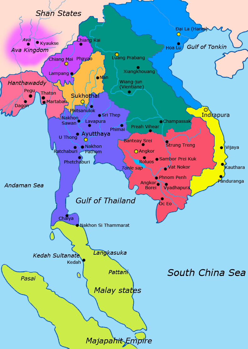
- On the map
- 1363–1708
- Greatest extent
- 1375, about 377,339 km²
- Read more
- Wikipedia: Lan Xang · Wikidata Q853477
Territory through time
| Years | Area drawn |
|---|---|
| 1363–1374 | 375,643 km² |
| 1375–1384 | 377,339 km² |
| 1385–1406 | 375,702 km² |
| 1407–1428 | 375,921 km² |
| 1429–1449 | 375,696 km² |
| 1450–1506 | 375,471 km² |
| 1507–1511 | 375,507 km² |
| 1512–1528 | 375,477 km² |
| 1529–1533 | 375,367 km² |
| 1534–1563 | 375,339 km² |
| 1564–1571 | 375,313 km² |
| 1572–1578 | 356,925 km² |
| 1588–1594 | 375,069 km² |
| 1595–1599 | 375,288 km² |
| 1600–1647 | 375,426 km² |
| 1648–1652 | 375,454 km² |
| 1653–1658 | 375,559 km² |
| 1659–1705 | 375,316 km² |
| 1706–1708 | 375,316 km² |