Realm · 1294–1518
Majapahit
Majapahit appears on the map from 1294 to 1518. At its greatest recorded extent, in 1363, it covered about 1.00 million km².
Majapahit was founded in 1293 by Raden Wijaya, a Javanese prince who cleverly used an invading Mongol army sent by Kublai Khan to defeat his rival, then turned on the Mongols and drove them out. From its capital at Trowulan in East Java the kingdom grew rich on rice farming and the spice trade. Under Queen Tribhuwana and her son Hayam Wuruk, the prime minister Gajah Mada vowed to unite the archipelago, and Majapahit claimed tribute from much of modern Indonesia, the Malay Peninsula and beyond, though it ruled directly mainly over Java, Madura and Bali. More about Majapahit.
See Majapahit on the map in 1363
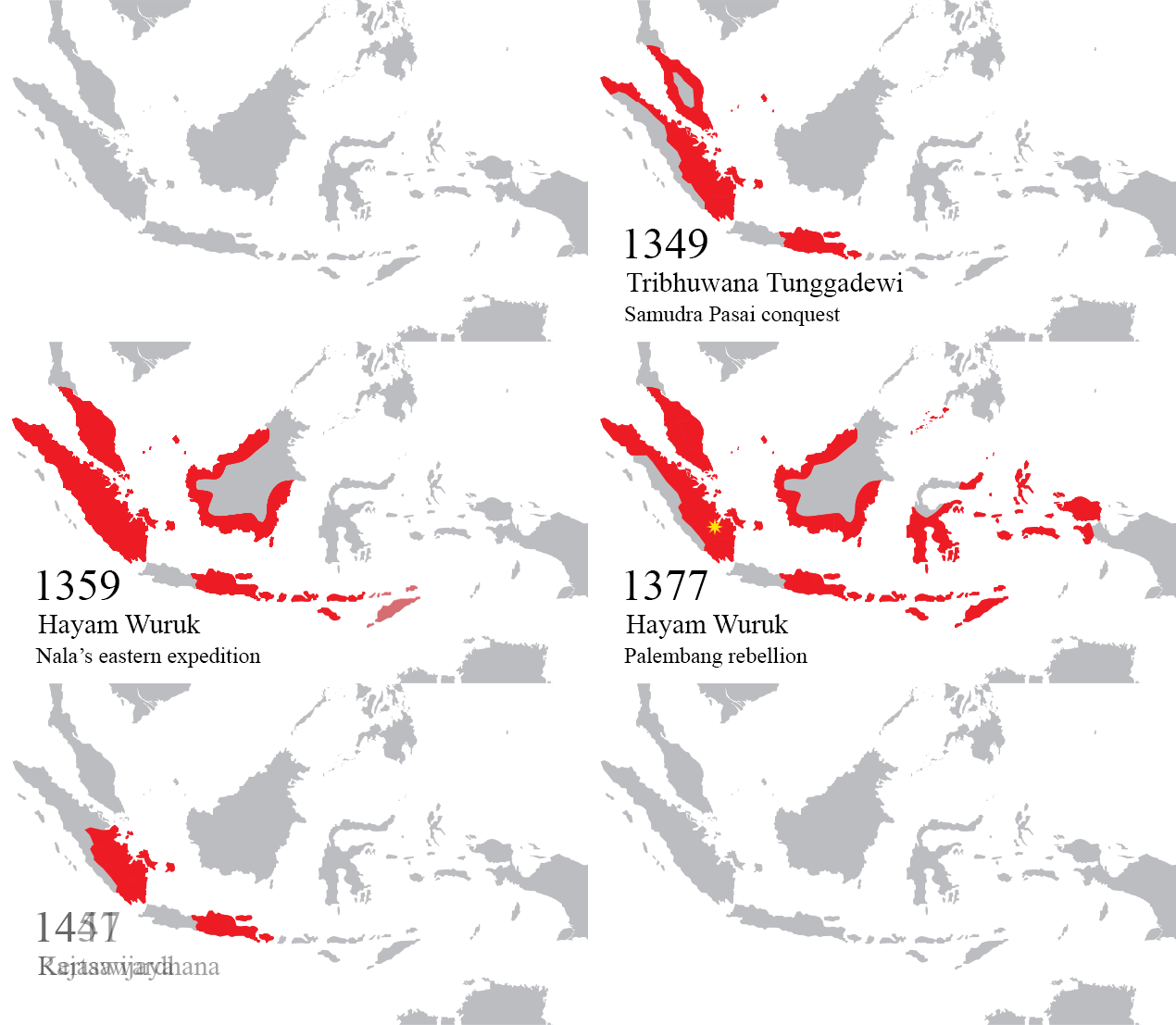
- On the map
- 1294–1518
- Greatest extent
- 1363, about 1.00 million km²
- Read more
- Wikipedia: Majapahit · Wikidata Q49326
Territory through time
| Years | Area drawn |
|---|---|
| 1294–1343 | 404,896 km² |
| 1344–1351 | 419,017 km² |
| 1352–1362 | 858,304 km² |
| 1363–1401 | 1.00 million km² |
| 1402–1474 | 1.00 million km² |
| 1475–1481 | 85,824 km² |
| 1482–1515 | 86,053 km² |
| 1516–1518 | 86,053 km² |
Related
- Majapahit empire