Realm · 1056–1240
Principality of Rostov-Suzdal
Principality of Rostov-Suzdal appears on the map from 1056 to 1240. At its greatest recorded extent, in 1227, it covered about 250,637 km².
See Principality of Rostov-Suzdal on the map in 1227
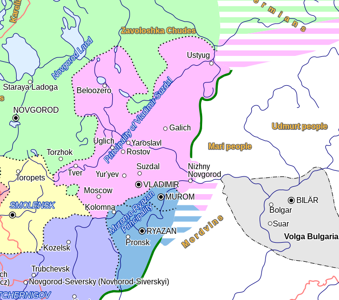
- On the map
- 1056–1240
- Greatest extent
- 1227, about 250,637 km²
- Read more
- Wikipedia: Vladimir-Suzdal · Wikidata Q83546
Territory through time
| Years | Area drawn |
|---|---|
| 1056–1071 | 167,085 km² |
| 1072–1093 | 169,857 km² |
| 1094–1125 | 169,731 km² |
| 1126–1226 | 245,432 km² |
| 1227–1235 | 250,637 km² |
| 1236–1240 | 250,486 km² |
Related
- Mongol conquests (1206–1260) 1206 – 3 September 1260