Realm · 674–1293
Srivijaya
Srivijaya appears on the map from 674 to 1293. At its greatest recorded extent, in 718, it covered about 537,553 km².
Srivijaya was a maritime empire centred on Palembang in southern Sumatra, first recorded in the 670s, when the Chinese Buddhist pilgrim Yijing studied Sanskrit there. Its rulers grew rich by controlling the Straits of Malacca and Sunda, the sea lanes between China and India, taxing passing ships and suppressing piracy, while drawing on Sumatran gold and forest products. Srivijaya was a federation of port-cities bound to the ruler by oaths, gifts and trade privileges rather than a tightly governed territory. More about Srivijaya.
See Srivijaya on the map in 718
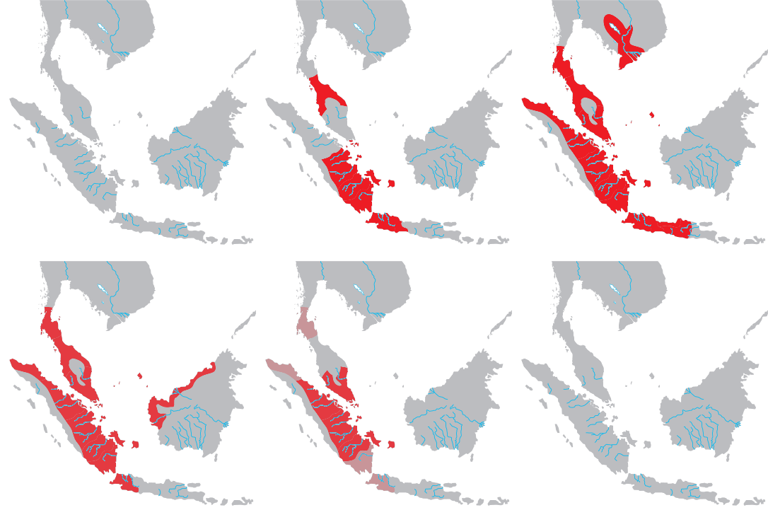
- On the map
- 674–1293
- Greatest extent
- 718, about 537,553 km²
- Read more
- Wikipedia: Srivijaya · Wikidata Q234197
Territory through time
| Years | Area drawn |
|---|---|
| 674–681 | 5,524 km² |
| 682–691 | 170,101 km² |
| 692–717 | 483,627 km² |
| 718–859 | 537,553 km² |
| 860–1138 | 537,553 km² |
| 1139–1201 | 456,772 km² |
| 1202–1284 | 456,772 km² |
| 1285–1293 | 456,772 km² |
Related
- Srivijaya empire
- The world in 800: Charlemagne Crowned chapter