Country · since 1363
Sultanate of Brunei
Sultanate of Brunei appears on the map from 1363 to today. At its greatest recorded extent, in 1512, it covered about 230,860 km².
See Sultanate of Brunei on the map in 1512
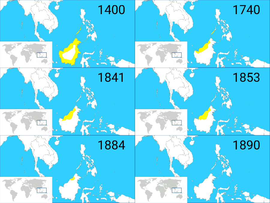
- On the map
- 1363 – today
- Greatest extent
- 1512, about 230,860 km²
Territory through time
| Years | Area drawn |
|---|---|
| 1363–1491 | 4,799 km² |
| 1492–1496 | 49,192 km² |
| 1497–1501 | 50,132 km² |
| 1502–1506 | 104,357 km² |
| 1507–1511 | 124,386 km² |
| 1512–1581 | 230,860 km² |
| 1582–1587 | 117,121 km² |
| 1588–1618 | 120,204 km² |
| 1619–1628 | 119,110 km² |
| 1629–1672 | 112,142 km² |
| 1673–1841 | 68,701 km² |
| 1842–1858 | 54,677 km² |
| 1859–1867 | 52,257 km² |
| 1868–1869 | 51,558 km² |
| 1870–1884 | 21,689 km² |
| 1885–1889 | 11,843 km² |
| 1984–1986 | 7,272 km² |
| 1987–1991 | 7,272 km² |
| since 1992 | 5,742 km² |