Realm · 1094–1313
Sultanate of Rum
Sultanate of Rum appears on the map from 1094 to 1313. At its greatest recorded extent, in 1094, it covered about 367,020 km².
One of the realms of Seljuk Empire and Sultanate of Rum. The Seljuks were a clan of Oghuz Turks from the steppes east of the Aral Sea who converted to Sunni Islam. Led by the brothers Tughril and Chaghri, they defeated the Ghaznavids at Dandanaqan in 1040 and swept into Iran, and Tughril entered Baghdad in 1055 as protector of the Abbasid caliph, who named him sultan.
See Sultanate of Rum on the map in 1094
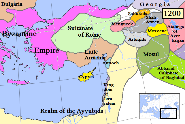
- On the map
- 1094–1313
- Greatest extent
- 1094, about 367,020 km²
- Read more
- Wikipedia: Sultanate of Rum · Wikidata Q975405
Territory through time
| Years | Area drawn |
|---|---|
| 1094–1098 | 367,020 km² |
| 1099–1138 | 128,919 km² |
| 1139–1146 | 128,756 km² |
| 1147–1151 | 129,149 km² |
| 1152–1176 | 129,169 km² |
| 1177–1187 | 173,237 km² |
| 1188–1191 | 252,369 km² |
| 1192–1201 | 258,075 km² |
| 1202–1205 | 319,379 km² |
| 1206–1209 | 329,286 km² |
| 1210–1215 | 347,252 km² |
| 1216–1226 | 347,467 km² |
| 1227–1249 | 347,276 km² |
| 1250–1259 | 192,084 km² |
| 1305–1313 | 71,760 km² |
Related
- Seljuk Empire and Sultanate of Rum empire
- First Crusade 1096 – 12 August 1099
- Third Crusade May 1189 – 9 October 1192