Realm · 1800–1949
Dutch East Indies
Dutch East Indies appears on the map from 1800 to 1949. At its greatest recorded extent, in 1915, it covered about 2.02 million km².
One of the realms of Dutch Republic and Dutch Colonial Empire. The Dutch Republic was born when seven northern provinces of the Habsburg Netherlands revolted against Philip II of Spain and renounced his rule in 1581. Its merchants built the most advanced commercial economy of the 17th century, and two chartered firms, the Dutch East India Company (VOC, 1602) and the West India Company (1621), carved out an empire of trade.
See Dutch East Indies on the map in 1915
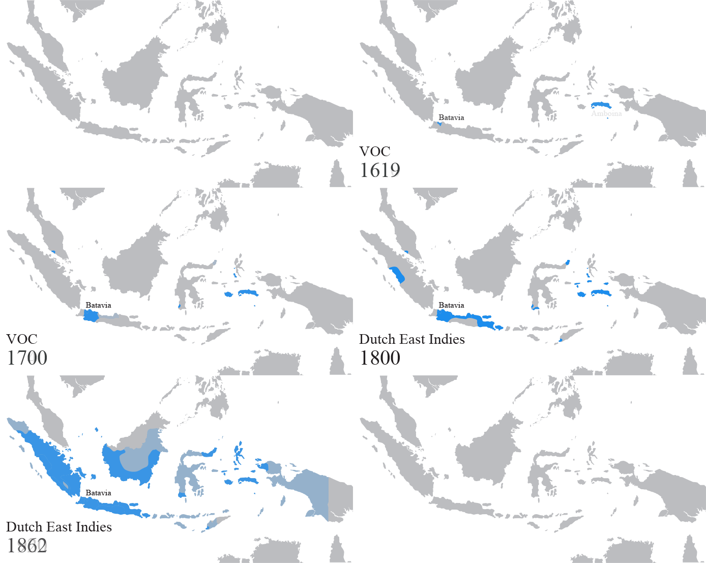
- On the map
- 1800–1949
- Greatest extent
- 1915, about 2.02 million km²
- Part of
- Batavian Republic, Netherlands
- Read more
- Wikipedia: Dutch East Indies · Wikidata Q188161
Territory through time
| Years | Area drawn |
|---|---|
| 1800–1802 | 223,687 km² |
| 1803–1804 | 267,782 km² |
| 1805–1808 | 224,021 km² |
| 1809–1813 | 289,688 km² |
| 1814 | 326,082 km² |
| 1815–1821 | 326,082 km² |
| 1822–1823 | 386,593 km² |
| 1824–1827 | 435,493 km² |
| 1828–1829 | 443,933 km² |
| 1830–1833 | 464,372 km² |
| 1834–1835 | 479,577 km² |
| 1836–1845 | 481,581 km² |
| 1846–1848 | 487,504 km² |
| 1849–1852 | 503,891 km² |
| 1853–1855 | 544,696 km² |
| 1856 | 564,582 km² |
| 1857–1858 | 668,407 km² |
| 1859 | 672,314 km² |
| 1860–1861 | 733,942 km² |
| 1862–1865 | 805,439 km² |
| 1866–1872 | 828,174 km² |
| 1873–1884 | 1.26 million km² |
| 1885–1889 | 1.26 million km² |
| 1890–1894 | 1.27 million km² |
| 1895–1897 | 1.61 million km² |
| 1898–1904 | 1.77 million km² |
| 1905–1907 | 1.80 million km² |
| 1908–1913 | 1.98 million km² |
| 1914 | 2.02 million km² |
| 1915–1940 | 2.02 million km² |
| 1941 | 2.02 million km² |
| 1942 | 1.96 million km² |
| 1946 | 1.41 million km² |
| 1947–1948 | 1.57 million km² |
| 1949 | 1.86 million km² |