Realm · 540–1282
Kingdom of Gwynedd
Kingdom of Gwynedd appears on the map from 540 to 1282. At its greatest recorded extent, in 1056, it covered about 23,247 km².
See Kingdom of Gwynedd on the map in 1056
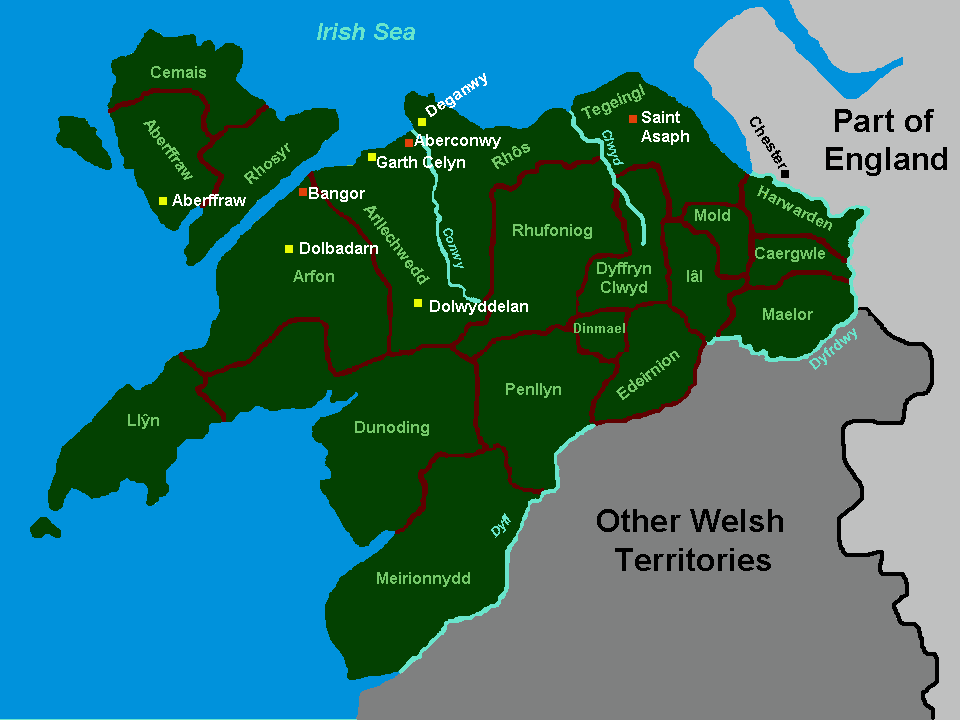
- On the map
- 540–1282
- Greatest extent
- 1056, about 23,247 km²
- Part of
- Brythonic Kingdoms
- Read more
- Wikipedia: Kingdom of Gwynedd · Wikidata Q816814
Territory through time
| Years | Area drawn |
|---|---|
| 540–591 | 8,086 km² |
| 592–625 | 7,979 km² |
| 626–632 | 7,245 km² |
| 633–655 | 7,979 km² |
| 656–660 | 8,086 km² |
| 661–704 | 7,979 km² |
| 705–859 | 6,364 km² |
| 860–865 | 10,721 km² |
| 866–869 | 10,634 km² |
| 870–874 | 10,721 km² |
| 875–877 | 15,166 km² |
| 878–921 | 6,364 km² |
| 960–1039 | 6,364 km² |
| 1040–1045 | 10,634 km² |
| 1046–1055 | 10,721 km² |
| 1056–1065 | 23,247 km² |
| 1066–1084 | 10,721 km² |
| 1085–1093 | 6,364 km² |
| 1099–1168 | 5,715 km² |
| 1169–1209 | 5,693 km² |
| 1210–1215 | 8,836 km² |
| 1216–1235 | 12,564 km² |
| 1236–1278 | 14,544 km² |
| 1279–1282 | 14,544 km² |